Showing posts with label Landforms. Show all posts

Sunday, December 30, 2012

Mount Waialeale, Kauai, Hawaii

Image

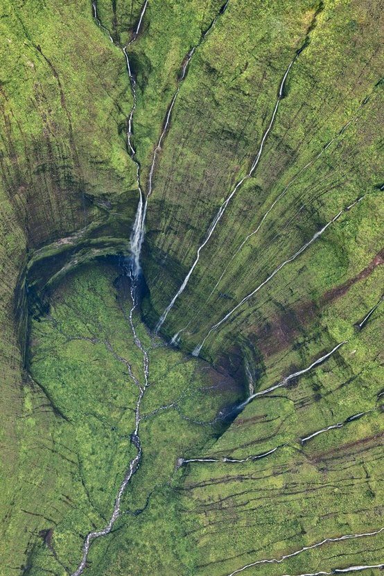
Mount Waialeale at an elevation of 5,148 feet (1,569 m), is a shield volcano and the second highest point on the island of Kauaʻi in the Hawaiian Islands. Averaging more than 452 inches (11,500 mm) of rain a year since 1912, with a record 683 inches (17,300 mm) in 1982, its summit is one of the rainiest spots on earth. Recent reports though mention that over the period 1978-2007 the wettest spot in Hawaii is Big Bog on Maui (404 inch per year), and that the rainfall in Hawaii is decreasing.

Image

The great rainfall in the area produces the Alakaʻi Wilderness Preserve, a large boggy area that is home to many rare plants. The ground is so wet that although trails exist, access by foot to the Waiʻaleʻale area is extremely difficult.

[youtube=http://www.youtube.com/watch?feature=player_embedded&v=z58vWt-rhMA]

Tuesday, November 6, 2012

Horseshoe Bend, Arizona, United States

Image

Horseshoe Bend is the name for a horseshoe-shaped meander of the Colorado River located near the town of Page, Arizona, in theUnited States. The bend is locally known as "King Bend." It is located 5 miles (8.0 km) downstream from the Glen Canyon Dam andLake Powell within Glen Canyon National Recreation Area, about 4 miles (6.4 km) southwest of Page. Accessible via a ½-mile (0.8 km) hike from U.S. Route 89, it can be viewed from the steep cliff above. According to Google terrain maps, the overlook is 4,200 feet (1,300 m) above sea level and the Colorado River is at 3,200 feet (980 m) above sea level making it a 1,000 feet (300 m) drop.